Jackie Raw discusses her recent article: Dispersal and coastal geomorphology limit potential for mangrove range expansion under climate change. Find out more about the implications of this work for modelling mangrove responses to climate change.
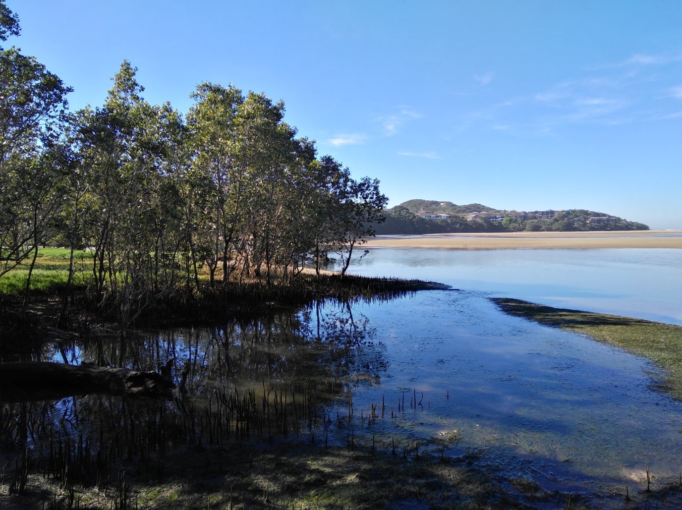
Mangroves, often described as tropical swamp lands, are classic features of warm coastlines where sea-surface temperatures are above 20°C. These ecosystems have persisted and adapted over millennia, leading to several assumptions about their potential responses to contemporary and future climate change. Most notably, mangroves are considered as a prime example for “tropicalization” under increasing global temperatures – as it gets warmer, tropical species will be able to establish and persist at higher latitudes as climatic conditions become more suitable in these areas.
This ‘poleward expansion’ of mangroves has been recorded at several continental range limits, where young new mangrove trees have been recorded at new locations in recent years. This has important implications, as mangroves have been shown to establish and encroach onto salt marshes, leading to changes ecosystem functioning and altering ecosystem services, including carbon storage and sequestration, nutrient filtration, and biodiversity support. Understanding regional and local drivers of mangrove distribution and how this could be impacted by climate change is therefore important for both local management approaches, and global-scale analyses of ecological-climate interactions.
Mangrove distribution is not controlled solely by temperature
The African southern range limit for mangroves occurs along the east coast of South Africa. Like other southern hemisphere range limits for mangroves in Australia, New Zealand, and Brazil, this coastline is characterised by high wave energy which restricts mangroves to occurring in sheltered estuaries. The distribution of mangroves in South Africa is patchy, with forests only occurring in 16% of the estuaries along the subtropical to warm-temperate transition zone. However, the potential for additional estuaries to support mangroves had already been tested over 50 years ago, when trees were transplanted ~70 km further south of the natural distribution limit. This mangrove forest persists today and has naturally expanded into adjacent salt marsh.
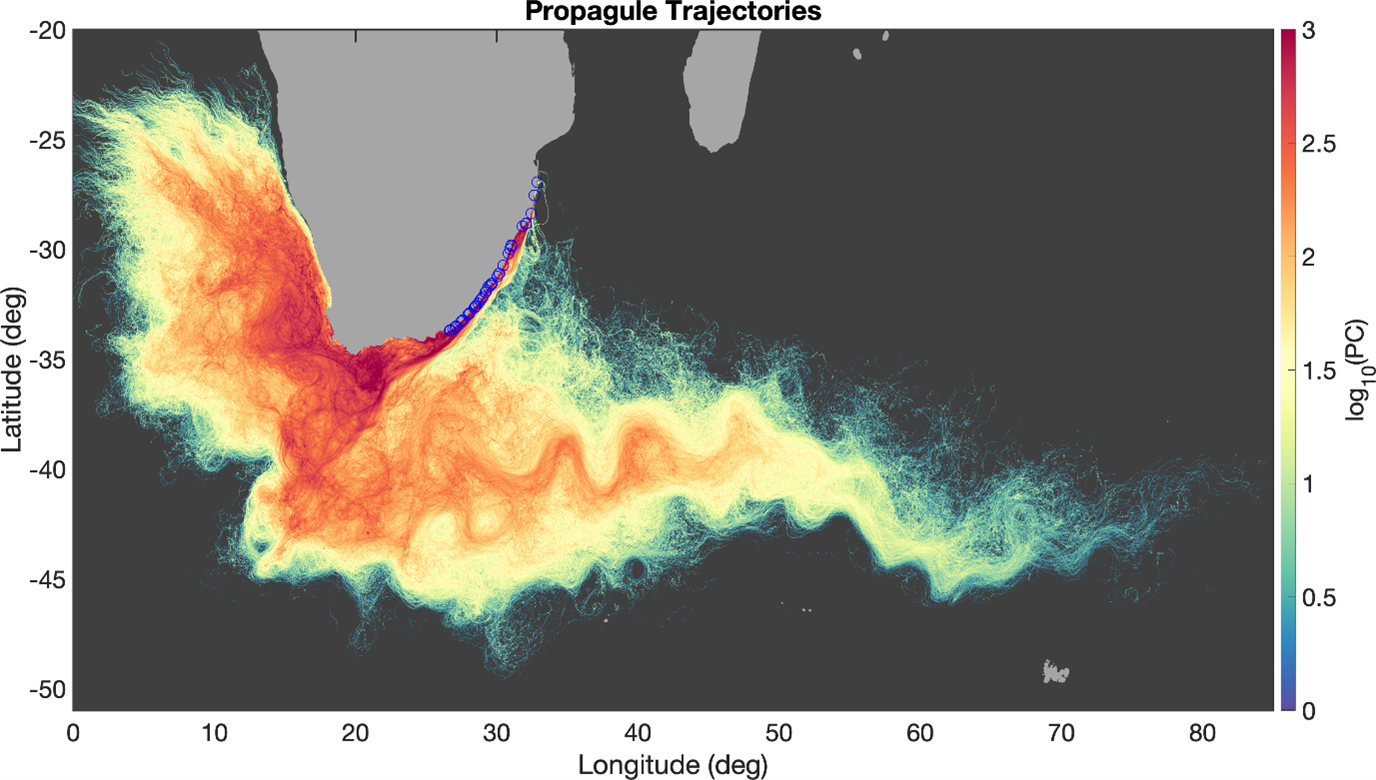
Given this occurrence, in this study we aimed to investigate whether other estuaries along this coastline could be suitable for mangroves (a reflection of the fundamental niche), if propagule dispersal could explain the observed distribution (the realised niche), and whether this would be impacted under different climate change scenarios (RCP4.5 and RCP8.5). To achieve this, we used a novel approach to combine species distribution models and propagule dispersal modelling for a robust quantitative assessment. Species distribution models (MaxEnt) were to identify estuaries with suitable conditions based on estuarine environmental variables that have been shown to explain mangrove distribution in this region (floodplain area, mean annual runoff, daily flushing rate, estuary mouth state, and average annual land temperature). We then cross-referenced these locations with potential propagule stranding sites using a connectivity matrix. The stranding sites were identified using a high-resolution particle tracking numerical ocean model that resolves meso-scale eddies and tides to develop floating ‘trajectories’ for propagules originating from the locations of established mangrove forests. We also repeated the species distribution modelling under modified estuarine environmental conditions based on predicted changes to temperature and rainfall by 2050 under climate change scenarios RCP4.5 (the intermediate scenario where emissions are projected to peak by 2040 and then decline towards 2100) and RCP8.5 (the worst-case, yet realistic scenario where emissions are projected to rise throughout the 21st century).
Oceanographic features and coastal geomorphology restrict mangrove distribution
The species distribution modelling approach showed that there are additional estuaries within the current range (± 900 km) that have environmental conditions that would be suitable to support mangroves at present. Of these, one system was verified to in fact be a new record for mangrove occurrence in the country which had previously not been formally recognised within the national estuarine botanical database. Additionally, when we considered estuaries along the contiguous ± 110 km of coastline towards the south of the present-day natural mangrove distribution limit, a further six systems were predicted as being suitable for mangroves by the model.
Propagule dispersal in this region reflected the primary flow direction of the Agulhas Current (south-to-westward). This is a warm, fast-flowing current, and the dispersal model indicated high potential for along-shore connectivity between estuarine mangroves in the region, with some tracks indicating potential transport around the Cape and towards the west coast of southern Africa. However, connectivity matrices showed that most mangrove propagules strand near their source forest, indicating that mangroves in this region largely recruit locally. This has also been reported in population genetics studies for the dominant mangrove species in the region – Avicennia marina. The high probability for local dispersal and nearby connectivity suggests that other estuaries that are environmentally suitable for mangroves are not accessible by propagules due to local-to-regional scale coastal and estuarine dynamics.
The South African coastline is characterised by strong wave energy and highly mobile sediments that often constrict estuary inlets. During low river flow these systems can remain closed to the sea, thus creating barriers for mangrove propagule dispersal and establishment. Other localised physical processes such as tidal fluctuations and submesoscale oceanographic features such as eddies, filaments, and fronts or coastal configurations can also all influence propagule dispersal. This results in the observed patchy distribution of mangroves at this range limit.
Climate change and the African southern range limit for mangroves
Under both future climate change scenarios, 30% of the estuaries that currently support mangrove forests are predicted to have unsuitable environmental conditions. The species distribution model outputs for these scenarios indicated that mean annual runoff was the environmental variable that contributed most to explaining model fit and variability. For these projected models, the 2050 estimates of mean annual runoff were derived from predicted changes in rainfall. Changes in mean annual runoff under climate change are expected to influence freshwater availability, but intense rainfall events can also lead to floods, scouring, and loss of mangrove habitat.
The 2050 models also indicated that six additional estuaries beyond the current distribution would become suitable for mangroves under climate change. However, when the locations of these estuaries were assessed in the connectivity matrices, it was also found that there is limited potential for propagules to strand at these new sites from established forests. Ultimately, if existing mangrove forests are lost in this region, it would lead to further fragmentation and reduced connectivity and even the possibility for a contraction in the range limit.
Mangroves are valued for their biodiversity contribution in South Africa, so management approaches need to focus on preventing further degradation to established forests, especially considering the existing local pressures on these ecosystems.
Jackie Raw Nelson Mandela University, South Africa
Read the full article online: Dispersal and coastal geomorphology limit potential for mangrove range expansion under climate change


